Resources for navigating the canal network
My good friend Sascha asked how folks navigate the canal network, given that Google Maps lacks directional detail. I thought this would be a great topic for a short post. Thanks Sascha!
These are the resources I use; there may be others of which I'm not aware, but this combination provides me with everything I've needed so far.
On the web
There are some great online resources. The Canal & River Trust's website is a good source of information generally, but it also has some great maps of the canal system.
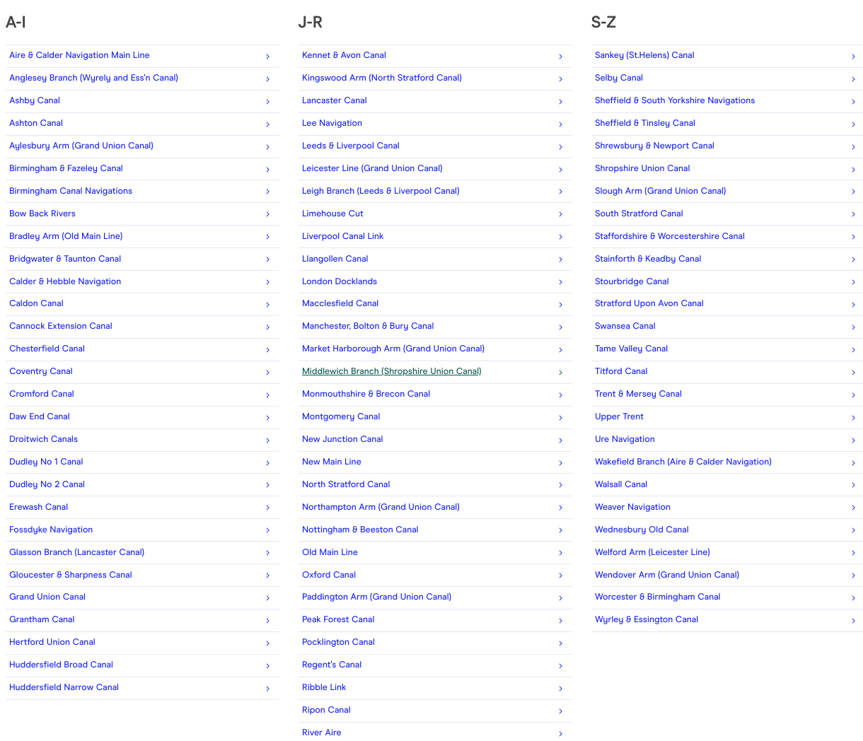
You can dive into the detail either by selecting a canal or river from the list:
Or you can start with the overall network map:
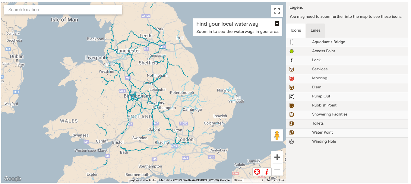
and then zoom in to see the detail:
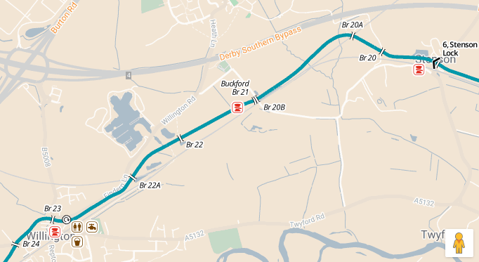
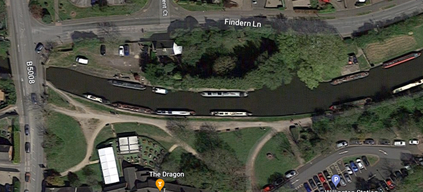
In this section, showing where I am right now (in the marina shown just west of Willington Rd) and a short section of the Trent & Mersey Canal, where you can see lots of detail such as:
- bridges
- mooring places
- on which side of the canal section the towpath is
- locks, and which way they are positioned (the direction of the chevron points "up")
- services (such as rubbish disposal, toilets, toilet cassette emptying facilities, water points, and so on)
- winding points
"winding" is pronounced as you would say "wind" as in what blows, rather than what you do with a clock
For me, the winding points are, from a navigation perspective, one of the most important features, in that they are almost the only places where you can turn round (canal junctions offer space too, but they are few and far between). They're short sections of the canal (usually between around 10 and 20 metres of canal length) where the canal is extra wide, usually going into a point, giving space to turn the narrowboat by 180 degrees.
In the case of this map section, it was good to know that there was a winding point in Willington, as I was coming along the Trent & Mersey canal from the east, and could rest assured that if I missed the entrance to Mercia Marina (just after bridge 22, going west) and had gone too far to reverse, I could continue to the winding point in Willington to turn round and go back.
Don't ask me why some bridges have letters after the numbers, and some don't. I haven't figured that out yet. I'm guessing it relates to where new bridges are added and there's no space numerically to insert them (why does this remind me of line numbering in steps of 10 in BASIC?).
This is in fact a good example of where Google Maps is actually very useful; often I'll use the satellite view to see what the turning point looks like, to gauge for example whether it's of a decent size, and what's nearby:
I can also avail myself of any street view resources too, which helps:
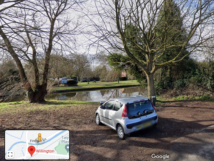
The combination of these CRT and Google Maps give me a good start in working out where I'm going, what's available where, and how I might get to my destination.
But there's an online resource that is far better suited to planning a journey on the canal system, and that is the awesome CanalPlanAC.
You can plan journeys from A to B, find and explore points by name, and get everything you need (and more) from the data that has been clearly lovingly gathered. I'd heartily recommend you explore what it has to offer, as I cannot begin to describe its richness.
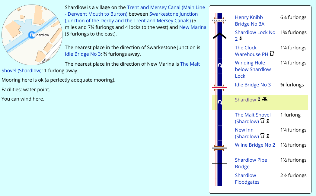
As well as having information on places, and how those places relate to other nearby places (this next screenshot is of the place Shardlow, where you can also see the nearest other places of interest, including pubs, winding holes, bridges and locks), you can plan routes in great detail.
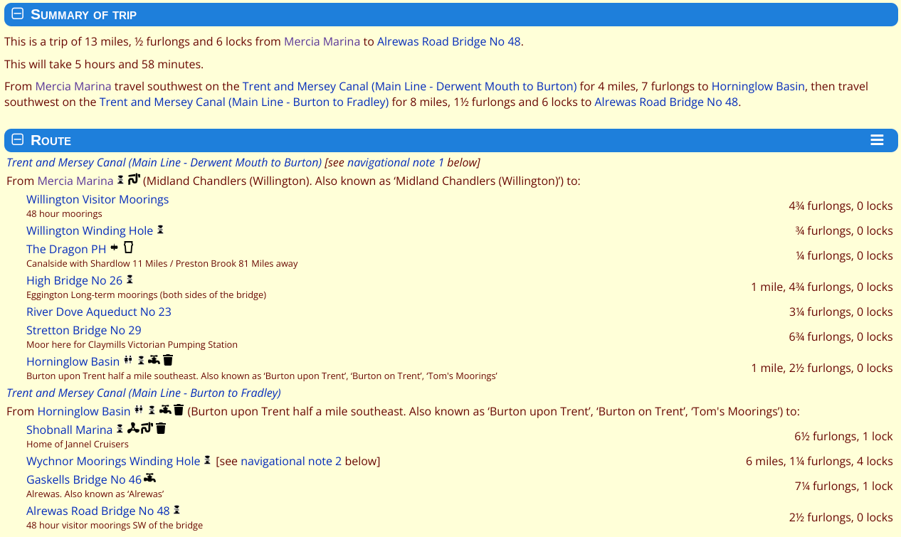
Here's an example of a route that I'm planning for the coming weekend, towards the village of Alrewas.
First, having looked at the CRT and Google Maps to work out roughly where I think I want to end up, I search for a point in CanalPlanAC, which offers me a list of specific and known places:
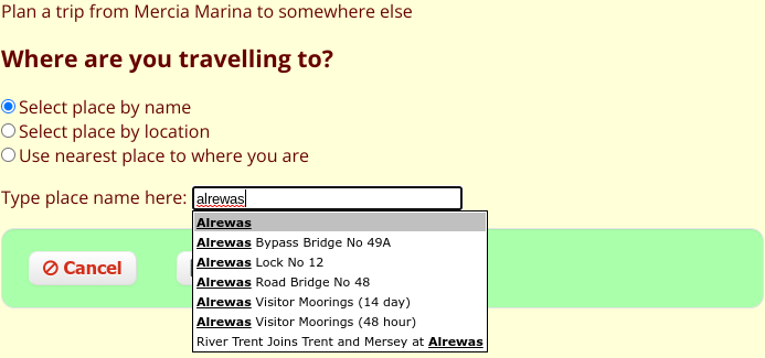
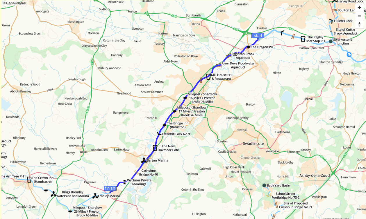
On choosing "Alrewas Road Bridge No 48" (which is roughly where I plan to moor on arrival), I'm taken to the custom journey page with everything I need, including a detailed route:
and an accompanying (and zoomable) map:
On the phone
While navigating I have my phone by my side, and have the Open Canal Map app open and ready to look at. It's a good combination of the CRT and CanalPlanAC resources, and is useful to quickly double check route details and re-confirm the locations of upcoming locks and winding points.
On paper
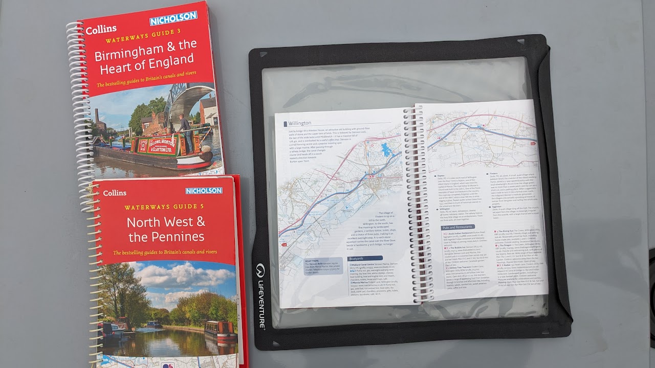
I have some of the Collins Nicholson Waterways Guides which are ringbound books that fold nicely flat and have maps and plenty of curated detail, with some useful opinionated navigation advice too based on experience.
Here's my collection, showing one of the guides (Four Counties & the Welsh Canals) open and inside a waterproof pouch so I can keep it on the stern with me even in the rain:
Other ways to plan navigation
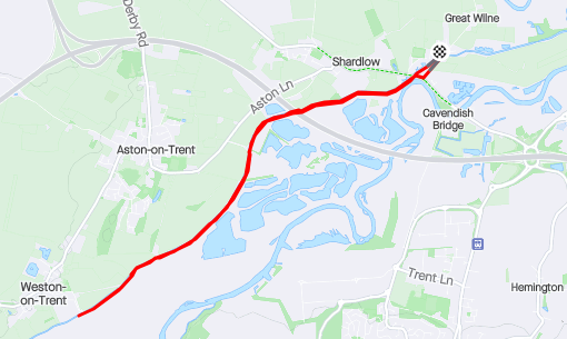
Of course, because canal navigation is on a fairly small scale, given the travel speed and the distances planned for any given journey, it's often the case that one can walk or run ahead to see what's coming. I have used some of my morning runs to do this; here's an example of a run from Shardlow, where I was moored, to Weston Lock, and back, to see what both Weston Lock and Aston Lock were like, and to check the canal stretch along the way: